Mobile coverage app for Android

See where the signal reaches.

Mast shows every Telstra, Optus, TPG and NBN fixed wireless tower in Australia. It predicts where each network's signal reaches and warns you before you drive out of coverage.

Coming soon toGoogle Play Join the waitlist

Android 10 or newer · No account · Works offline

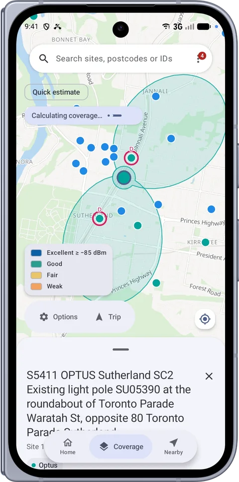
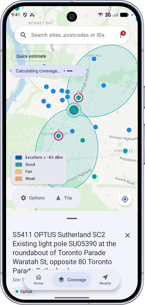
Mast on a Pixel 10 Pro showing a tower's predicted coverage on the map, with a legend from Excellent to Weak

Mast starts with public data from the ACMA register and recognised radio planning methods. Then it checks the map against your phone's real signal.

Every tower

Every tower in Australia.

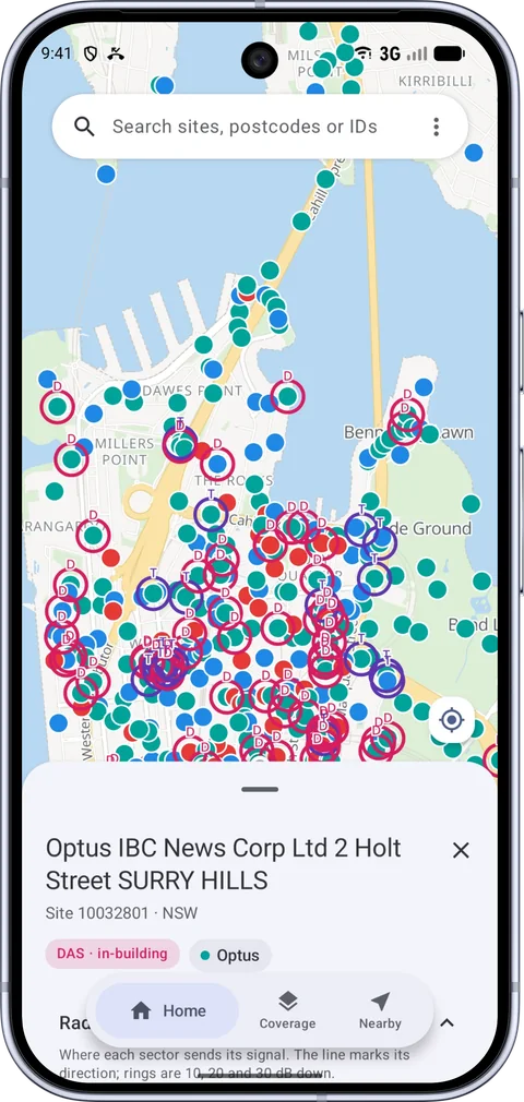
About 25,000 sites and 850,000 transmitters from the ACMA register. The data updates by itself each week when you're on Wi-Fi.

Tower details

See which way each antenna faces.

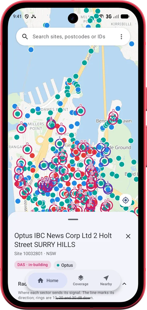
Tap a tower to see every sector with its direction, bands, power, height and antenna model. Its radiation pattern is drawn right on the map.

Nearby

The towers around you.

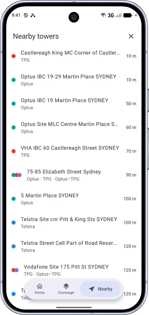
See the closest sites in a list, sorted by distance, with the networks on each one.
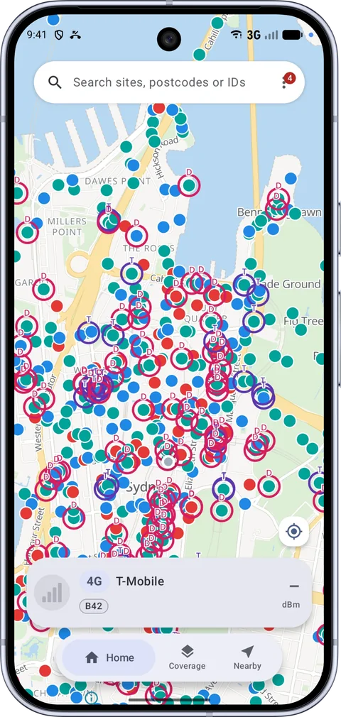
Mast map of central Sydney covered in tower markers coloured by network, with in-building sites circled Mast tower details for an Optus in-building site in Surry Hills, tagged DAS in-building Mast Nearby towers list showing Sydney sites with their networks and distances from 10 to 120 metres
Predicted coverage

A map of where the signal should be.

Pick a network and Mast colours the map from Excellent to Weak. Choose 4G and 5G or 5G only, switch on indoor mode, or open the reliability view to see the chance you'll actually have signal.

Long-press anywhere on the map to get a reading for that spot.

Excellent Good Fair Weak
Long-press reading Predicted −97 dBm
Good 82% reliable

Best sector Telstra n78 · 1.2 km

Proper radio models

Predictions use recognised radio planning methods from ITU and 3GPP propagation models.

Hills and buildings

Copernicus elevation data shows where hills and valleys block signal. Building footprints account for built-up areas.

Worked out on your phone

A native C++ engine runs the numbers and draws the map with your phone's GPU. It's fast and there's no server involved.

It's a prediction. The coverage in Mast is an estimate, not a guarantee. Use it as a guide alongside what your phone tells you.

Mast · Trip
Leaving Telstra coverage in ~1.8 km Dead zone ~6 km
Back in coverage
Trip mode

Know before you lose signal.

Start a trip and Mast looks ahead along the road you're on. It tells you before you reach a dead zone, then again when you're back in coverage.

Turn on voice alerts if you'd rather not look. On Android 16 the trip shows as a Live Update in the status bar, and in the Now Bar on Samsung phones, with a coloured strip of the coverage ahead. There's a Quick Settings tile to start it too.

Features

What else Mast does

Your live connection

A card shows your carrier, 4G or 5G including 5G+ and LTE-A, band, carrier aggregation and signal strength. A line on the map points to the tower you're on. Dual SIM works too.

Gets better as you go

Mast compares your phone's real signal with the prediction and corrects the map along the places you go. This learning stays on your phone.

Tunnels and buildings

Mast recognises in-building and tunnel antenna systems and tells you when you're connected to one. In tunnels it keeps your position moving when GPS drops out.

Works offline

Download whole states, cities or highway corridors with the base map and terrain. It all keeps working with no signal, which is when you need it most.

Android Auto

A signal panel on the car screen shows your carrier, 5G, band and signal bars. Trip alerts show there too, and trips can start by themselves when you plug in.

Search and filter

Find a site by suburb, postcode or site ID. Filter the map by network, by 4G or 5G, and by band.

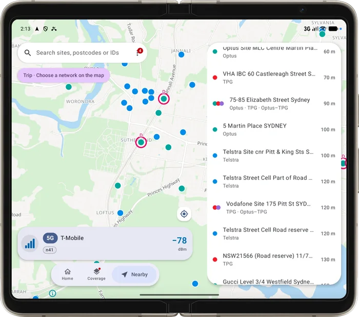
Mast on a Pixel 10 Pro Mast on a Pixel 10a Mast on the outer screen of a folded Pixel 10 Pro Fold Mast on an open Pixel Fold with the map on the left and the nearby towers list on the right
Pixel 10 Pro

Made for modern Android.

Mast uses Material You, so it picks up the colours of your wallpaper. It has light and dark themes, and the maps aim for a smooth 120 Hz.

Pixel 10a

Android 10 or newer.

The layouts are tuned for Google Pixel and Samsung Galaxy phones, and it runs on any phone with Android 10 or newer.

Pixel 10 Pro Fold

Ready for foldables.

There are layouts for foldables like Pixel Fold, Galaxy Z Fold and Galaxy Z Flip.

Pixel Fold, opened

More room for the map.

On a big inner screen, the map and the list of nearby towers sit side by side.

How it works

From public data to your map

  1. 1

    Tower data

    Sites and transmitters come from the ACMA Register of Radiocommunications Licences, updated each week.

  2. 2

    Antenna patterns

    ACMA's measured patterns show where each antenna sends its signal, for about 98% of transmitters.

  3. 3

    Terrain and buildings

    Elevation and building data show where hills and built-up areas get in the way.

  4. 4

    On-device engine

    Your phone works out the coverage and draws it, with no server in between.

  5. 5

    Your real signal

    Your phone's own measurements correct the map where you go. They stay on your phone.

Privacy

Nothing to sign up for

No account, ads or tracking

There's no sign-up. The app has no ads, no analytics and no tracking.

Public and open data

Tower data comes from the public ACMA register. Map, terrain and building data come from free open sources.

Measurements stay on your phone

Calibration readings are saved on your phone. You can view them, export them or delete them.

Permissions with a reason

Location, phone state and Bluetooth are only used for the features on this page. Mast never reads your calls, messages or phone number.

FAQ

Common questions

Does Mast work offline?

Yes. Download a state, a city or a highway corridor before you go. That includes the base map and terrain, so the map, towers and coverage keep working with no signal.

Which networks does it show?

Telstra, Optus and TPG, which includes Vodafone, plus NBN fixed wireless. It shows every one of their transmitters in the ACMA register.

Is the coverage map exact?

No. It's a prediction based on tower data, antenna patterns, terrain and buildings, so treat it as a guide. As you use the app it compares the map with your phone's real signal and corrects it along the places you go.

Will it drain my battery?

The coverage is worked out on your phone, so there's no waiting on a server. Trip mode uses GPS while a trip is running, the same as a navigation app, so it's worth plugging in on long drives.

Why is it only on Android?

Mast reads details about your phone's mobile connection, like the band and the tower you're connected to. Android lets apps read these details. iPhone doesn't share most of them with apps.

Does it work with Android Auto?

Yes. The Google Play version will show the signal panel and trip alerts on your car screen. A version installed outside Google Play also shows a map with a line to the tower you're connected to.

Is Mast made by a phone company?

No. Mast is made by Cylix, an independent developer in Australia. It isn't connected to or endorsed by ACMA or any phone company. It uses public data from the ACMA register.

When can I get it?

Mast is still being built. Join the waitlist below and I'll email you when it's on Google Play.

Join the waitlist

Mast is coming to Google Play. Leave your email and I'll let you know when it's out. I won't use it for anything else.

See how your email is handled in the privacy policy.

Data sources

Contains data from the ACMA Register of Radiocommunications Licences. Map data © OpenStreetMap contributors. Elevation from Copernicus DEM, © ESA / DLR / Airbus. Building footprints from Microsoft.

Mast isn't affiliated with or endorsed by ACMA, Telstra, Optus, TPG, Vodafone, NBN Co, Google or Samsung. Network names are used only to describe the data. Android, Android Auto, Google Play and Pixel are trademarks of Google LLC. Samsung and Galaxy are trademarks of Samsung Electronics.